More meetings with lawyers and more paperwork. Another lot of submissions and waiting… I’m finally getting the hang of last minute decisions on where to go riding next.
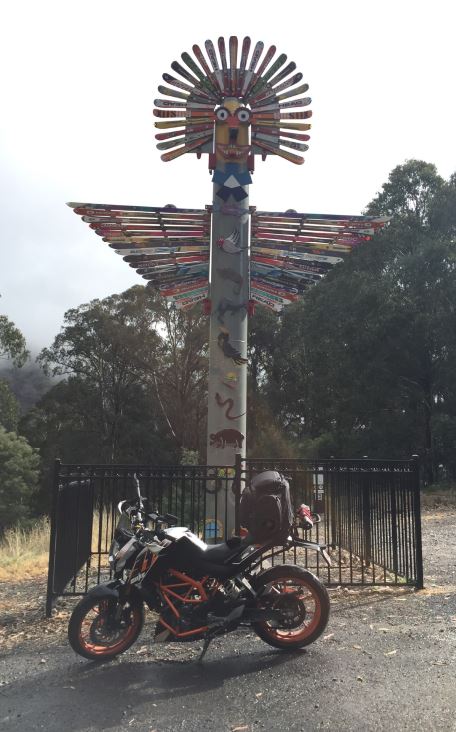
Due to a predicted spattering of two ‘good’ weather days, didn’t hesitate, packed the bag, loaded the Lawnmower and off I went to another mountain I had not been to. One that was a little too far for a daytrip at this time of day – Mt Buller. Nothing to do with Bulla ice-creams as I originally thought, but all to do with another ski resort.
I was on a mission to get to all the mountains as I could before winter hit. I don’t think I now mind riding in slippery roads, but it’s the cold that kills me. I am just not made for being on a naked bike so unprotected in close to zero degrees temperatures with wind chill.
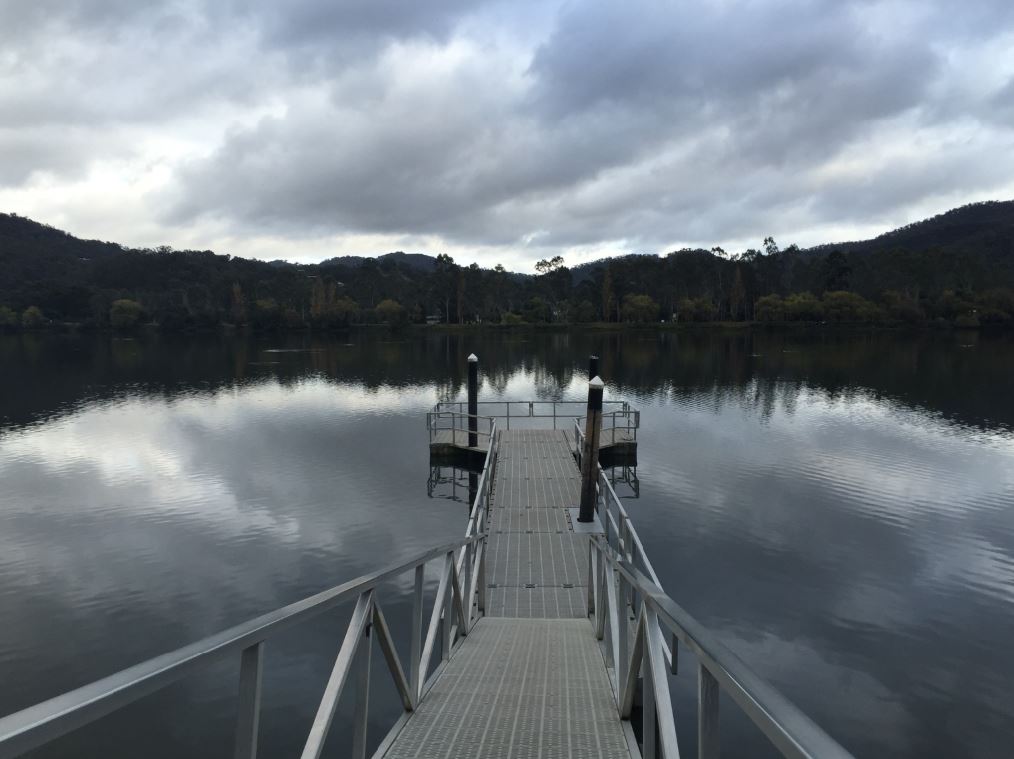
Left Melbourne round 6am as not to get caught up in peak hour traffic. Before I knew it, I was past Marysville and well on my way to Eildon Lakes for my first stop. Breakky was going to be muesli bar by the glassy lake. Gorgeous! These are the times I would love a REAL camera!!

The calm, glassy water reflecting the grey clouds, and not a single person on the lake. A couple of lone ducks minding their business could be seen in the distance. I did a bit of a walk on the edge where I could taking in its stillness….until said ducks spotted me with food, and made a beeline for me. This shattered the glassy look at the surface and was my signal to get out of there.
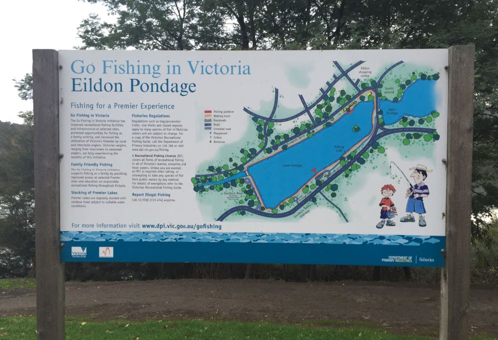
Apparently the fishing is well worth it here and there are plenty of places to fish from shore, pontoons or picnic areas to spend a day with the family.
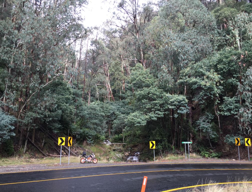
Saddled up with a little trepidation as the next part of the trip, is where I had heard mixed reviews of Eildon-Jamieson Road. It’s a non-stop twisty road, isolated and with no reception. Connecting nowhere to nowhere in particular, not a place where you want to breakdown or stack it. Due to its isolation I had also heard it had many large kangaroos about, so would have to keep my eyes peeled while riding.
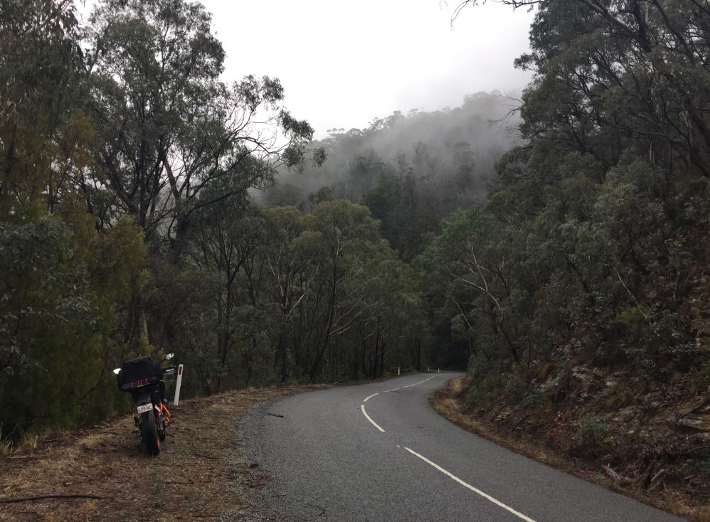
This road starts off on the southern area as being in the low areas, with swampy looking vegetation. Lots of ground covers, mosses, giant ferns, lots of water and mist. Looked like a yowie would feel right at home here, with plenty of places to hide and ambush their prey. This is the area precisely where I felt more nervour riding in since there was no reception here, everything was fairly damp and slippery, moss covered corners, and there was plenty of kangaroos. A few did cross my path, however thankfully, they were quite ahead of me when they did so. Phew!
There were more roos than cars along this road… Nicest part was literally cutting fog as you rode higher in elevation and the trees started to thin out in places, giving you glimpses of beyond.

Plenty of lovely corners, for sure. But quite a few can be blind corners, so there’s always a little element of danger. For what seemed like hours of fun, I passed Jamieson and popped out to Mansfield Woods Point Road, which pointed me towards Mansfield. I was aiming to get here for fuel and a feed before attempting the next stretch to Mt Buller.
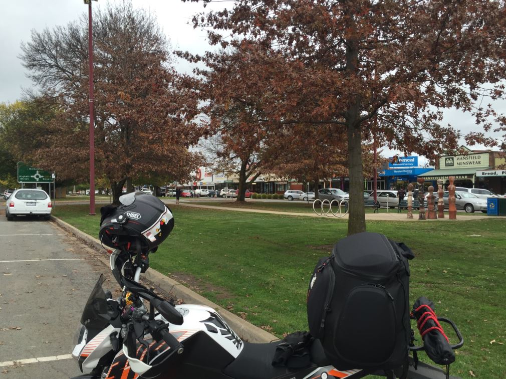
Mansfield has a pretty main street with manicured trees, all busting out in Autumn colours. Plenty of car park spaces on the sides, with the middle of the road or parts thereof, devoted to parks, pedestrian access and picnic tables. It was way too chilly for me to sit outside and eat my paced lunch, so I went inside one of the many coffee shops lining the street for warm recharge. Here I looked at my maps, made a few notes and layered up again to go up to the summit. The locals told me that it had not been raining in town, but didn’t tell me that it had been raining at the top however.
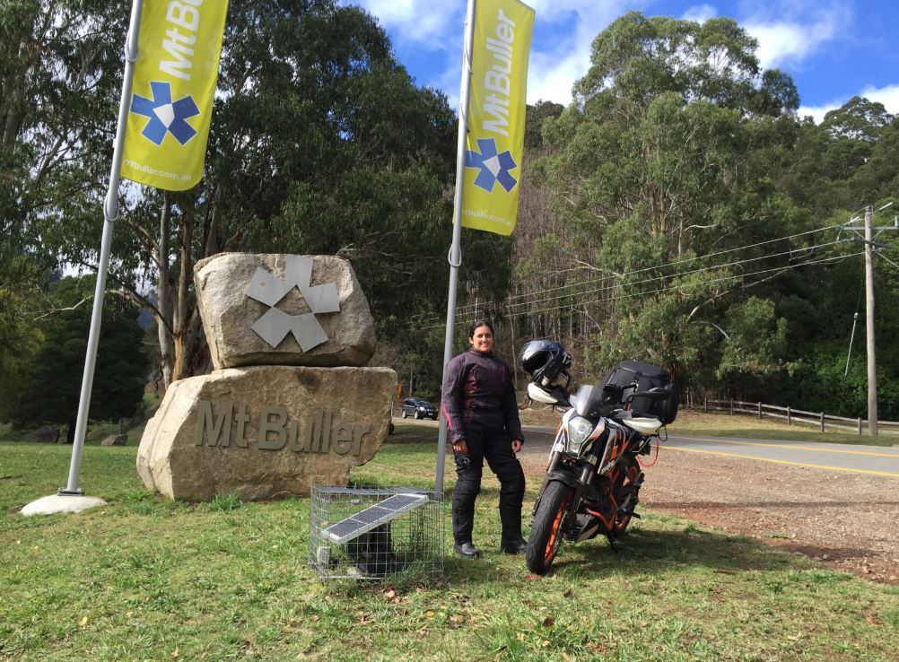
I set off the warmth of the café and towards Mt Buller. Can’t miss it because it’s only a one way in and out road, and you can see this mountain jutting out from the distance.
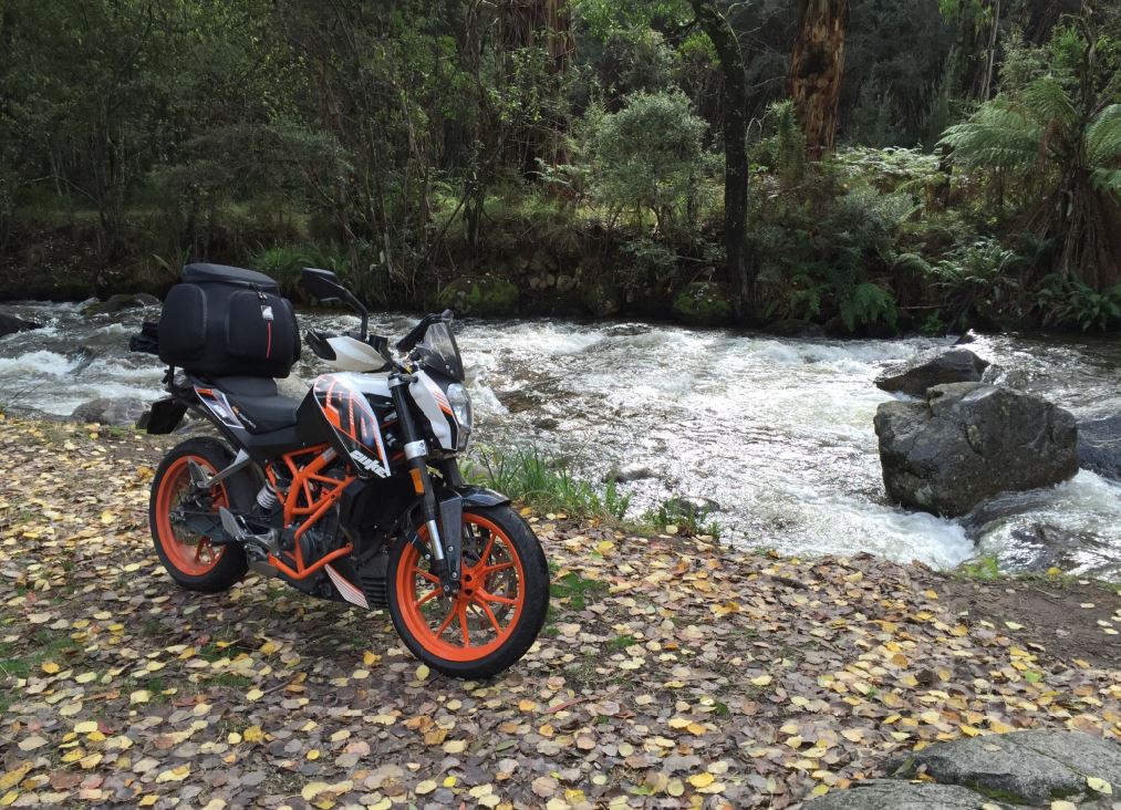
As I was riding I saw this area had many, many little creeks crossing differing areas, so I stopped to investigate a rest area that was particularly pretty. When I rode up to the creek, I was surprised at how strong and how much water was coming down… didn’t quite click, that a) a mountain was nearby and b) just how much rain comes in this area!
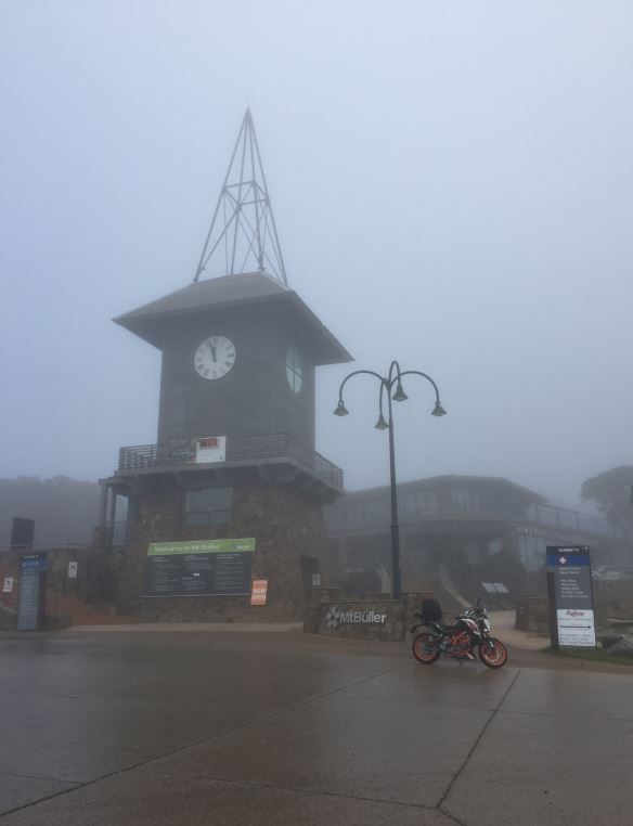
As I started climbing, the semi bluish skies started getting greyer and thicker. I mentally was crossing my fingers for it to be, not rainy for my summit. I even stopped at the Ski-God half way up to make a peace offering for safe journeying!
But the more I climbed, the colder and colder it was getting. The wetter the road, the lower and thicker the clouds became to the point of drizzle and then rain 😦 Was making the climb a bit more challenging, especially in the tight corners, seeing little water rivulets cross in front of me. I lost traction a few times and had little bum-pucker moments as these occurred. Had to slow down to about 40km/hr max to feel secure.
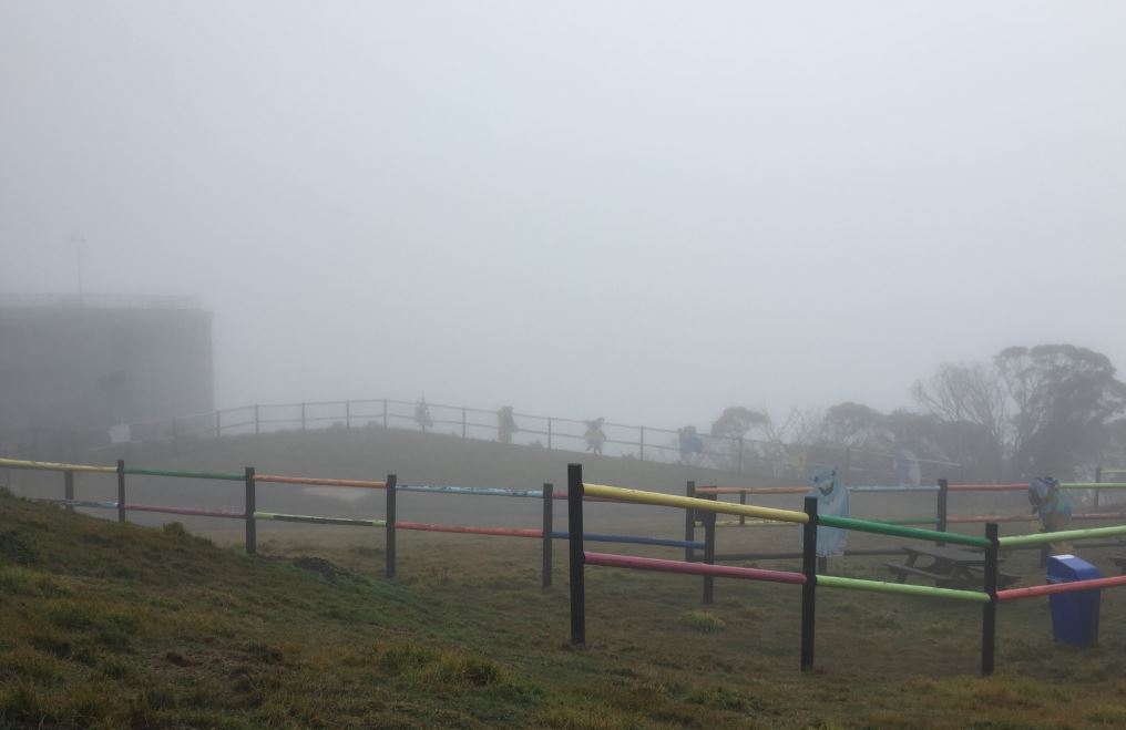
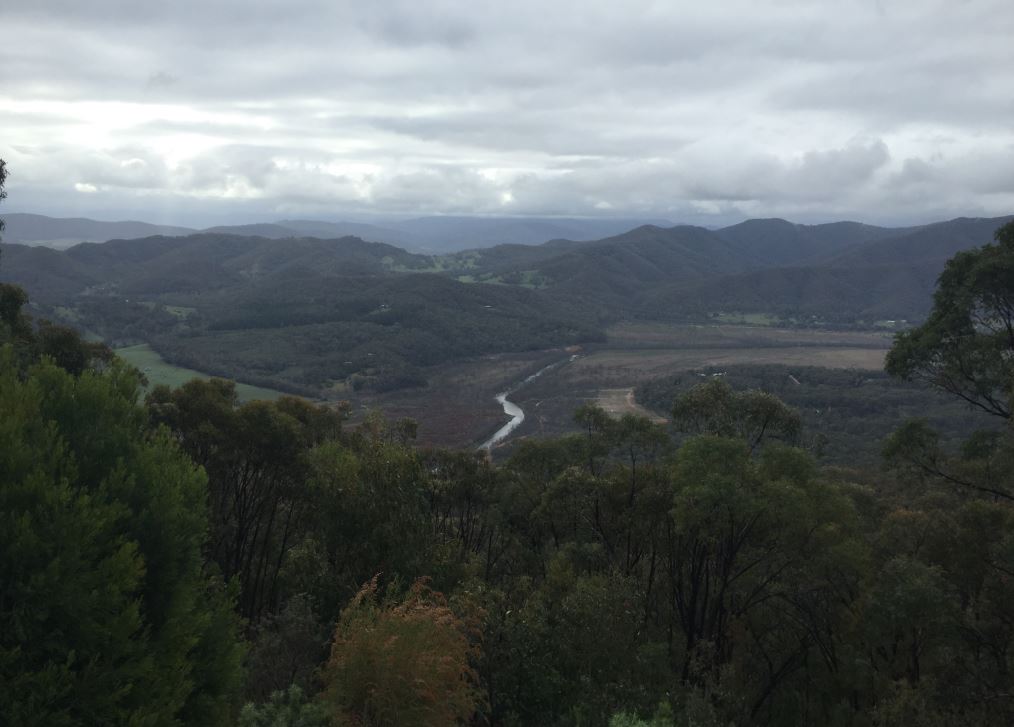
When I got to the top, the view was not spectacular…. Because there simply wasn’t one! Grrrr. All this way for not a thing! Even though the digital gauge on the clock tower was saying it was 7 degrees, I think it was closer to 0.7C! I was a bit damp and shivering.

No real point in me hanging about here any longer, so back on the bike and down the mountain I went. I guess the offering to the ski god wasn’t enough to have appeased him to let me see this place, and I know this was the case, because half way down, the clouds cleared and stopped raining!
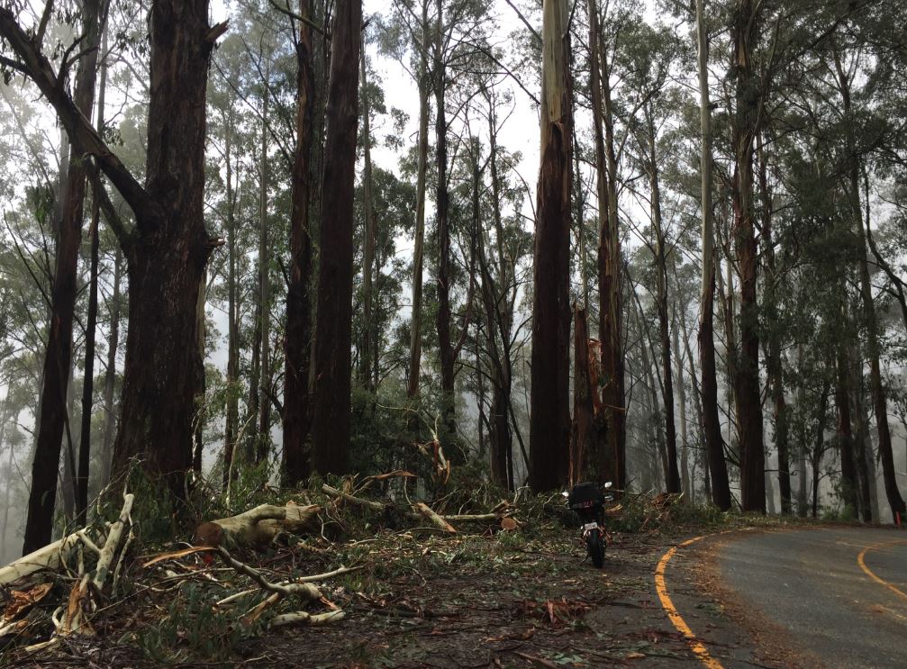
I stopped to take a photo of some of the trees along these parts, as they are pretty impressive. The trunks may almost be as wide as the Lawnmower, so I wouldn’t want to be here in a windy day or in a storm where these giants hit the deck. Like this one. Just scary.

But they sure make the place beautiful, together with the raging waters. Gives the road, rather than a trip feeling, a ‘journey’ feeling as you are riding along.
Back at the bottom of the mountain, where the blue skies busted out again, and there was even a slight bit of warmth in the air – maybe, to help dry me off. The ride back into Mansfield was quick, with another fuel stop and get going away towards Myrtleford.
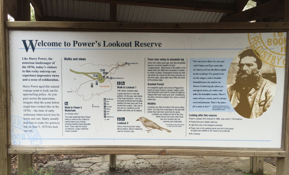
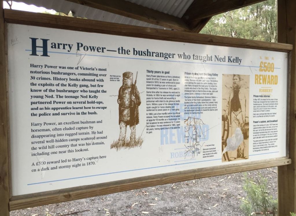
As a little side trip to the main route, a lookout caught my eye – Power’s Lookout. The view at the time wasn’t all that fantastic since it was quite cloudy and I thought the name came from the whopping great big powerlines that were prominent in view, but found out from the signs at the lookout that it was to do with the ‘gentlemanly bush ranger’ that taught the famous Ned Kelly’s ways… who knew?
Made a quick comfort stop, mental note, I’d love to camp here…. And then left back up the gravel road onto the main road.

Onto Whitfield and pressing on to Myrtleford as I knew I was going to be cutting it fine to get to Bright by sundown. The few kilometres into Whitfield are just divine and juicy to any biker. I forgot what the speed limit was actually, but in the twisty downhill sections, I just did the speed in which the Lawnmower seemed most comfortable in. Moving the throttle full range for a bit, as there’s not many places with corners so delectable and downhill to enjoy 🙂
Another v quick comfort stop at Myrtleford, as the sun started looking its strength and the light seemed to be defusing.
And last press towards Bright. A place where I had been told about many bikers are one of ‘the’ overnight places to stay at. Trendy, very cozy little village in the mountains style. So I had to see it. This was all well and good, but it also meant = expensive. So much so that I was not able to stay in Bright for the night, and instead found the cheapest caravan park cabin, in the town beforehand called Porepunkah. The cheaper cousin. So, quick as a flash I booked in, threw the bag into the cabin, turned the heater on, and left to Bright, weightless to see the sunset colours.
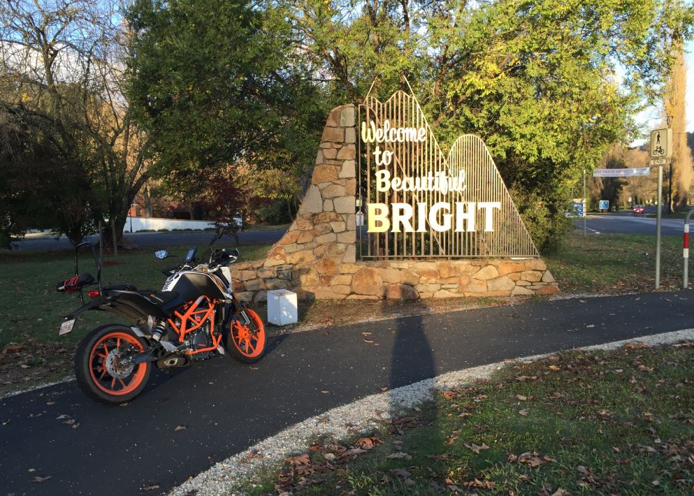
Just made it in time to see the sun setting, and busting out the warm colours, bathing the little town in it.


As soon as the sun went behind the mountain, I took off back down the road to Porepunkah, to jump out of the riding gear, into a warm shower and cabin 🙂 Tomorrow is another day of exploring… Can’t wait for tomorrow’s summit to Buffalo! I’ve heard so much about this mystical looking mountain, with its differing moods and seasons.

